The Coastal States Organization represents the nation’s Coastal States, Territories, and Commonwealths on ocean, coastal, and Great Lakes resource issues. Having trouble opening links? View this on our website: https://coastalstates.org/resources/ |
|
Ways El Niño and Large Marine Heatwave Could Affect West Coast Marine Species |
|
Source: California Department of Fish and Wildlife |
|
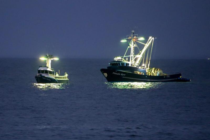
| A large marine heatwave has bathed parts of the West Coast in very warm ocean waters over the past year, breaking temperature records in the Pacific. NOAA has also announced that El Niño has developed in the tropical Pacific and is predicted to intensify to a moderate or strong level this fall. El Niño represents another form of marine warming, though with different drivers and influences. The prolonged period of high temperatures could affect fisheries and marine life in the California Current that have already been buffeted by shifting ocean conditions over the last decade. We have seen these back-to-back heat events before. About a decade ago, a major marine heatwave known as “The Blob” began raising ocean temperatures off the West Coast, peaking in 2015. The Pacific endured a record count of tropical cyclones and the Caribbean Sea and parts of Africa experienced severe droughts. That situation was more extreme than now, with the Blob lasting longer and affecting the entire West Coast compared to the smaller recent marine heatwave. However, research and observations during that unprecedented climatic pileup suggest the kind of changes we may see in the coming months along the West Coast. Though these changes are centered in the Pacific, they have far-reaching impacts. The extreme El Niño a decade ago saw significant negative impacts to coastal wildlife and communities, including malnourished sea lion pups, harmful algal blooms, and increased whale entanglement risk. Read more here. |
|
| In the States and Territories |
|
| Massachusetts – Healey-Driscoll Administration Awards $150,000 in Grants to Protect Habitat and Water Quality in the Buzzards Bay Watershed The Healey-Driscoll Administration today announced $150,000 for land conservation projects in the Buzzards Bay watershed. The two grants are awarded by the Buzzards Bay National Estuary Program (NEP) through the Massachusetts Office of Coastal Zone Management. “Permanently protecting conservation land in Massachusetts is a smart investment that provides lasting benefits for communities and the environment,” said Coastal Zone Management Director and Interim Director of the Buzzards Bay NEP Alison Brizius. The Towns of Bourne and Plymouth will each receive $75,000 to permanently protect land at the head of Buttermilk Bay. The Buttermilk Bay Land Conservation Project, a partnership between the Buzzards Bay Coalition and the two municipalities, will protect more than 390 acres of forested uplands, cranberry bogs, and wetlands. Read more here. Rhode Island – CRMC, DEM Designate Additional Westerly Parcels for Conservation and Public Space The Rhode Island Coastal Resources Management Council (CRMC), along with the Rhode Island Department of Environmental Management (DEM) and Town of Westerly, have designated additional parcels in Westerly for conservation and coastal public access. In April 2025, the partners announced that more than seven acres of land at the former Water Wizz site on Winnapaug Pond were placed under a conservation easement with designated public access. Two additional parcels have been purchased, bringing the total to about 10 acres of conservation land connecting to a contiguous 15-acre DEM-managed salt marsh. CRMC and DEM will jointly hold the conservation easement and manage the easement with the Town of Westerly. Public access will include at least 10 designated parking spots for the public to access the site and Winnapaug Pond, and additional parking will be provided for those with kayaks or small watercraft. Read more here. |
| South Florida Water Management District and Army Corps of Engineers Sign Everglades Restoration Deal On Tuesday, the South Florida Water Management District and the U.S. Army Corps of Engineers signed a first-of-its-kind agreement to advance key Everglades restoration projects in South Florida. The agreement ensures that federal funding will be provided to Florida for key projects that line up with the completion of the Everglades Agricultural Area Reservoir by the USACE in 2029, a news release said. Some of the projects include state construction of the final EAA Reservoir component and the Blue Shanty Flow Way Project, which unlocks a vital system to deliver more clean water across Tamiami Trail and Florida Bay, the release said. Read more here. Glass Half Full turns Party Glass into Louisiana Coastline Most locals have heard the statistics: roughly a football field of Louisiana is lost to the sea every hour. Glass Half Full started in 2020 in a backyard near Tulane University, when Trautmann and her classmate Max Steitz couldn’t figure out where to recycle their wine bottles. The 20-somethings’ pipe dreams are now a full-scale operation atop a 3-acre (1.2-hectare) plant just outside New Orleans. GHF’s partner, GlassRoots, runs about 40 locations citywide where people can drop off their household glass. Additionally, dozens of restaurants and bars in town have dedicated glass bins with multiple weekly pickups. “In 2024 alone we went through half a million pounds of glass [about 227 metric tons], which is quite a bit,” said Brice Abadie, general manager of the famed Carousel Bar at the Hotel Monteleone in New Orleans. Read more here. |
| Ohio – ODNR’s Office of Coastal Management Publishes Updated Lake Erie Public Access Guidebook The Ohio Department of Natural Resources Office of Coastal Management released a fully updated Lake Erie Public Access Guidebook, a resource for exploring Ohio’s 312-mile Lake Erie coast. This 348-page publication includes a detailed listing of all public parks, nature preserves, wildlife areas, beaches, boat ramps, fishing piers, and scenic vistas. In addition to coastal sites along Ohio’s Lake Erie shore, the guidebook also includes locations situated on the major rivers flowing into Lake Erie. Altogether, the publication highlights 201 Lake Erie public access sites and 320 sites located along the 14 major river systems that flow into the lake. Read more here. Michigan – With Coastline Restoration Project, Ford House Shores Up Property for Improved Ecological Future Visitors can now see how restoration of Ford Cove and the nearly milelong stretch of Lake St. Clair shoreline adjacent to the Edsel and Eleanor Ford House in Grosse Pointe Shores has brought the area back to a more natural state. The entire project was funded by the National Oceanic and Atmospheric Administration. Through the Great Lakes Commission, NOAA supplied $227,634 for a feasibility study, and then NOAA gave the Ford House a Transformational Habitat Restoration and Coastal Resilience grant of $7,052,050 through the Bipartisan Infrastructure Law and Inflation Reduction Act for engineering, design and construction. “The shoreline restoration project was not about building a barrier or reinforcing a bank,” Ford House President and CEO Mark Heppner said. “It was about restoring a balance — a balance between nature and community, between preservation and progress. From the very beginning, the partners approached this project with a deep respect for the environment and a commitment to sustainable practices. Through careful planning, collaborative design and environmentally conscious construction, we have worked to reclaim and protect this vital stretch of waterfront.” Read more here. |
| West Coast Gray Whale Estimate Shows Increase, New Count Determines Researchers at NOAA Fisheries’ Southwest Fisheries Science Center estimate that the Eastern North Pacific gray whale population is between 15,930 to 20,530, or an average of about 17,750 gray whales. That is a jump from last year’s estimate—one of the lowest since counting began in the late 1960s—which numbered between 11,690 to 13,190, or about 12,890 whales. Eastern North Pacific gray whales rebounded from lows during the commercial whaling era and were removed from the list of endangered species in 1994. Their numbers climbed to an estimated peak in 2015–2016 of between 24,890 and 29,760, or an average of about 27,000 whales. Read more here. California – Goat Island Restoration Grant Funding Secured The Solano Land Trust announced last week it has secured $7 million for the Goat Island Restoration and Public Access Improvement project. The project is “the final piece of a four-part vision two decades in the making. This funding will restore wildlife habitat, improve water quality, expand accessible trails, and bring hands-on marsh education to local schoolchildren,” Nicole Braddock, chief executive officer for the Land Trust, said in a July newsletter. The funds come from two sources: a $4 million grant from the state Environmental Protection agency, and a $3 million grant from the California State Coastal Conservancy. The 80-acre piece is part of the 2,070 Rush Ranch property. When the work is completed, tidal flows will return to the area, and a trail – including a boardwalk into the marsh – will be constructed for public access. Read more here. |
| [NEW] California Ocean & Coastal Amateur Photography Contest California is in many ways defined by its coast and ocean. This contest pays tribute to these special places, honors the diversity of wildlife they support, and celebrates access for all. Pictures can feature any of the following subjects: the scenic coast and Pacific Ocean off California, the people of the California Coast, and California ocean and coastal wildlife. Contest entry is free and open to all amateur photographers. Submissions are due by 5pm, September 30, 2026. For more information or questions about entries, contact Lauren.Dung@coastal.ca.gov. Learn more here. TNC Launches New Tool for Coastal Resilience TNC and partners released a first‑of‑its‑kind Coastal Resilience methodology that quantifies, in U.S. dollars, the flood-protection value mangroves and tidal marshes deliver to coastal property and communities. Natural protections like mangroves and tidal marshes absorb incoming wave energy at higher rates, protect against storms at lower costs, and provide co-benefits like carbon absorption that mitigates future climate impacts. If a portion of our current protection spending was shifted toward nature‑based solutions, infrastructure needs would reduce, maintenance costs would lower and future flood damages could be avoided. Learn about the tool here. NOAA Announces New High-Resolution Land Cover Data NOAA has announced the availability of new high-resolution land cover data—used to document key geographic and landscape features covering Earth’s surface—for coastal communities in Puget Sound, Rhode Island, Northeast Ohio, Mississippi, and Alabama. This new data can be used to protect communities from flooding, inform wetland restoration projects, improve water quality, and more. The data are available from the Digital Coast website. Please reach out to Nate Herold (nate.herold@noaa.gov) if you have any questions. Call for Abstracts ASBPA 100th Anniversary Conference The American Shore and Beach Preservation Association (ASBPA) is pleased to announce a Call for Abstracts for the National Coastal Conference, celebrating 100 years of shore and beach preservation, to be held in New Jersey where in 1926 the first beach preservationists seeded a revolutionary idea for future coastal protection. The ASBPA National Coastal Conference, October 5-8, 2026 in Atlantic City, New Jersey, welcomes all coastal managers and stakeholders to learn the latest science, engineering, and policy needed to maintain and improve the health of our beachfront and estuarine shorelines and ecosystems, while developing collaborative networks to promote best management practices. Abstracts are due August 15th for Poster Presentations. View the call for abstracts here. Funding Opportunity: Fiscal Year 2024 & 2025 Building Resilient Infrastructure and Communities The Building Resilient Infrastructure and Communities (BRIC) grant program makes federal funds available to states, U.S. territories, federally recognized tribal governments, and local governments for hazard mitigation activities. It does so by recognizing the need to upgrade and modernize the nation’s infrastructure against the growing risks to communities and the need for natural hazard risk mitigation activities that promote resilience with respect to natural hazards. For this funding opportunity, the program prioritizes investment in infrastructure and construction projects that deliver immediate, measurable risk reduction to communities vulnerable to natural hazards. BRIC emphasizes the adoption and enforcement of modern building codes and limits capability- and capacity-building activities to those directly tied to infrastructure resilience, such as building code adoption and enforcement. Apply here. |
|
| The views expressed in articles referenced here are those of the authors and do not represent or reflect the views of CSO. If you have a news item or job posting to include in future CSO Newsletters, please send an email to: ecrocco@coastalstates.org with a subject line: “Newsletter Content”. Please include the information to be considered in the body of the email. Please note: CSO reserves final decision regarding published newsletter content and may not use all information submitted. |
|
| Coastal States Organization | 50 F Street. NW, Suite 570, Washington, DC 20001 | 202-800-0580 | cso@coastalstates.org | www.coastalstates.org |
|
|
|
|